In association with Shelby County’s Regional Resilience Plan, Fisher Arnold was engaged to oversee and direct the hydrologic and hydraulic modeling efforts in updating the models for Shelby County’s three major waterways – Loosahatchie River, Wolf River, and Nonconnah Creek.
Fisher Arnold’s team was lead consultant in preparing an initial HEC-HMS hydrologic model for the basins of all three waterways and for the HEC-RAS model of the Wolf River. As lead consultant, our team provided the Loosahatchie River and Nonconnah Creek consultants with the initial HEC-HMS model for establishment of peak flows for the 2011 historic event and the 10, 50, 100 and 500-Year synthetic storm events. The calibration of the HEC-HMS model utilized data from the 2011 historic event and two other historic events for each waterway.
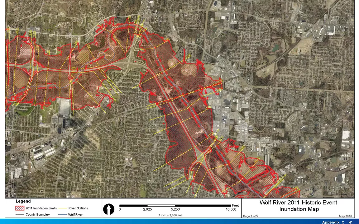
Fisher Arnold was also responsible for the creation of the HEC-RAS model for Wolf River. The hydrologic modeling involved utilization of LiDAR data, NEXRAD data, gage data and previously performed studies to model the entire basins. HEC-RAS modeling of the Wolf River involved field work to obtain 115 bridge and channel cross sections, as well as bridge measurements. Utilizing the results of the 2011 historic storm event and other historic storms, the HEC-RAS model for Wolf River was finalized, and maps were created for the flood limits for the historic 2011 storm event, the 100-Year storm event and the 500-Year storm event.Additionally, we were program directors for establishing the basin delineations, preferred methodologies, and report parameters to ensure consistency between each of the consultant teams’ efforts.